
JMap NG - Improvements
Improvements and new features are continuously being added to the JMap NG app. Here's a look at what's changed in JMap NG over the past few months.
Performances
Optimizations have been made in the JMap NG code to achieve better performance with projects with a high number of layers. For example, with a 500-layer project, we could observe delays when interacting with the map or layer panel. With these optimizations, the delays are gone and the user experience is much better.
Transparency of image layers
We've added an option that allows you to adjust the transparency of image layers.
Having adjustable transparency on images is often useful for seeing other data that is under the images. It is now possible. Just go to the More Information section of an image layer, and then to the General tab. A slider allows you to adjust the level of transparency between 0% and 100%.
Zoom in on the extent of a layer
JMap NG already allowed you to zoom in on the extent of a layer. But we've made it even simpler and more convenient: double-clicking on the name of a layer in the project zooms in on its extent. In addition, we have added a visual indicator that temporarily shows the limits of the extent.
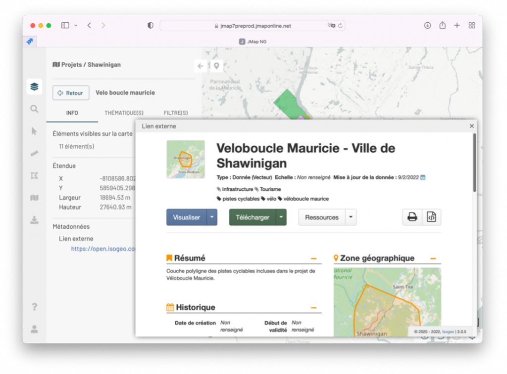
Metadata
If metadata is configured for a layer's data source, it can now be viewed from JMap NG. Go to the More Information section, General tab, to see the metadata or the link to it, if it comes from another system.
Filters
Filters for vector layer data are accessible in JMap NG. Preconfigured filters in the project can be enabled or disabled, and the user can compose their own filter using the desired operators and attributes.
The filters are available in the More Information section, Filters tab. The presence of a filter that is active on a layer is indicated by a small icon in the panel of layers.
Tip: When you save a map, the map retains the filters that are active at the time the map is saved.
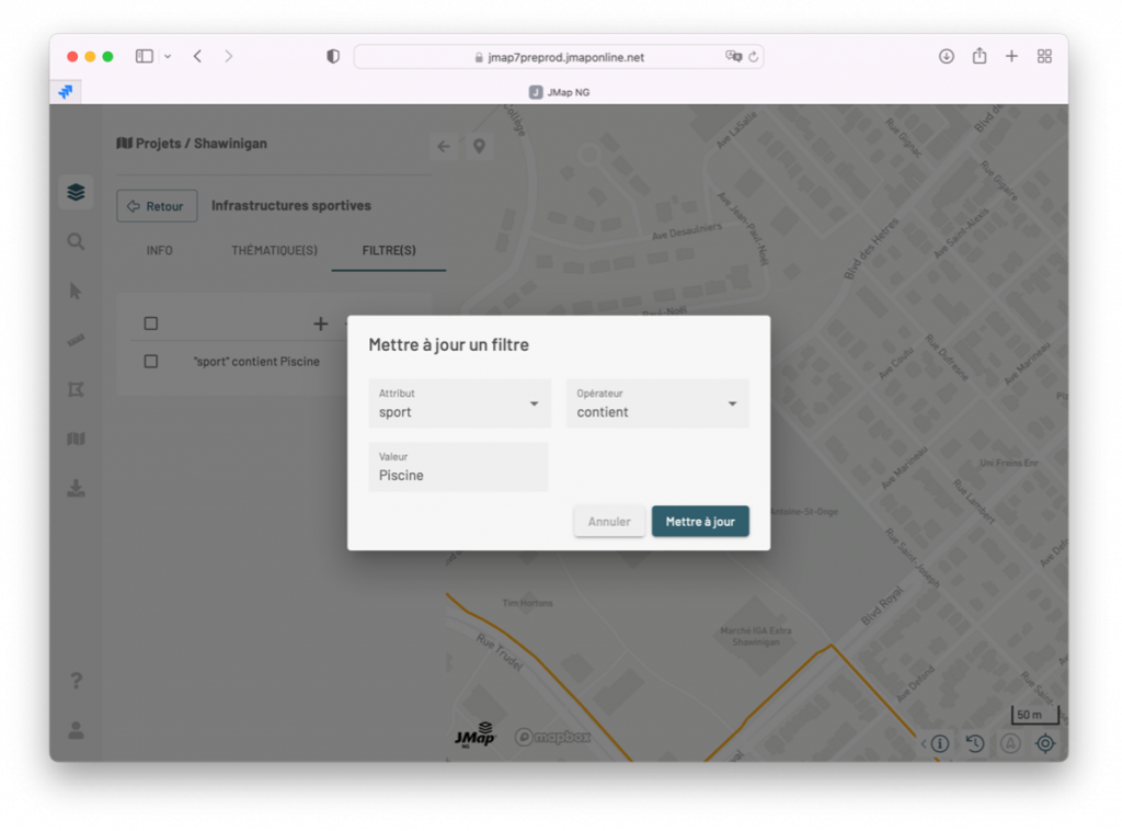
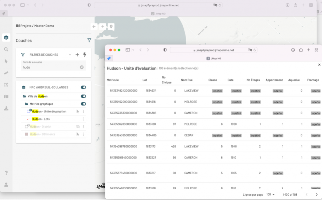
Table of attributes in a separate window
The attribute table shows the attributes of the selected items on the map. In addition to the display at the bottom of the screen, you can now transfer it to a separate window, while maintaining interactivity with the map (clicking on a row zooms in on the corresponding item).
Suggested Content

New Connection between JMap and Isogeo Platforms


1440 Sainte-Catherine O.,
Bureau 522
Montreal, QC H3G 1R8
+1 866-967-1211
USA
One Boston Place,
Suite 2600
Boston, MA 02108
+1 617-933-7265